Karaikal Fm
Type Locality and Naming
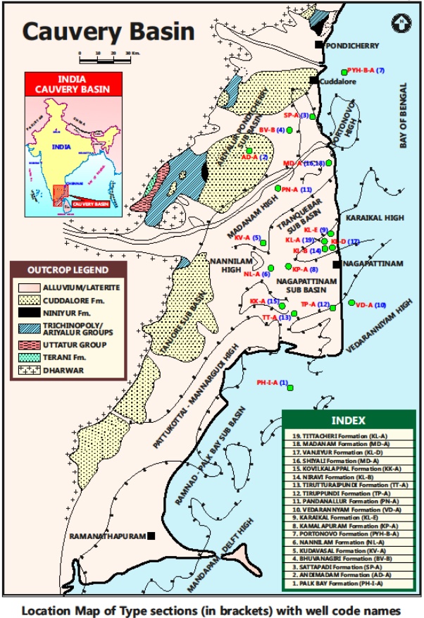
SUBSURFACE: The type section is located at exploratory well Karaikal-E (depth interval: 1945-1580 m), in the Nagapattinam subbasin. The hypostratotype is in the Well Tirukkadiyur-A (depth interval-2390-1710 m). It was named after the Karaikal village by ONGC team headed by Venkatarengan et al.(1993) and issued as Document-VII by KDMIPE, ONGC, Dehradun (1993).
[Figure 1: Type-section Map of Subsurface Formations]
Lithology and Thickness
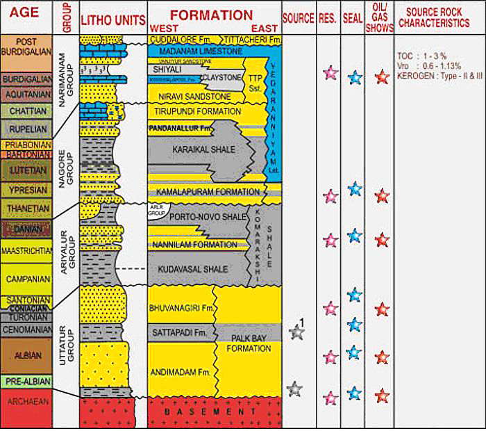
Claystone. This formation is predominantly shale. It is gray, silty, fissile and occasionally calcareous, micaceous, with disseminated pyrite crystals. This formation is predominantly shale. It is gray, silty, fissile and occasionally calcareous, micaceous, with disseminated pyrite crystals. Its thickness varies from 365-1000 m. Part of Nagora Gr.
[Figure 2: Generalized Stratigraphy and Petroleum System of Cauvery Basin (from dghindia.gov.in)]
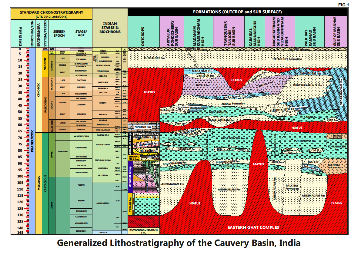
[Figure 3: Generalized Stratigraphy of Cauvery Basin (Provided by A. Nallapa Reddy & R. Nagendra)]
Relationships and Distribution
Lower contact
Unconformable with the Kamalapuram Fm / Portonovo Fm or Komarakshi Fm.
Upper contact
It is conformably overlain by a variety of formations viz. Tirupundi Fm, Pandanallur Fm, Niravi Fm, Shiyali Fm, Tirutturaipundi Fm and Tittacheri Fm.
Regional extent
It has two main depocenters, one in the north of Karaikal high and the other in south near Mandapam area extending towards Mannar subbasin
GeoJSON
Fossils
Diagnostic planktonic foraminifera: Morozovella velascoensis, Planorotalites pseudomenardii, Igorina pusilla, Subbotina pseudobulloides
Age
Depositional setting
Middle to Outer neritic.
Additional Information
The argillaceous section above the KT Boundary is sand rich in parts of the basin and named as Kamalapuram Fm; and if it is represented by shale, named as Karaikal Fm.


